ML-x17 DATA LOGGER MANUAL
Manufacturers of low power instruments
page 58
4.19.4.1
GPS
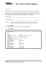
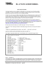
$GPGGA,172814.0,3723.46587704,N,12202.26957864,W,2,6,1.2,18.893,M,-25.669,M,2.0,0031*4F
When using the ‘Generic NMEA’ driver instead of the ‘GPS’ driver to input GPS coordinates you might
need to do a conversion from dddmm.mmmm N/S/E/W format to +/- ddd.dddddd format. This can be
accomplished by using a calculated channel for both the latitude and the longitude.
Latitude formula:
(floor(:GGA2/100)+((:GGA2/100)-floor(:GGA2/100))/0.6)*eq(:GGA3;83;-1;1)
Longitude formula:
(floor(:GGA4/100)+((:GGA4/100)-floor(:GGA4/100))/0.6)*eq(:GGA5;87;-1;1)
Assuming:
GGA2 is the latitude (2
nd
field position), GGA3 is the direction (3
th
field,
83=’S’)
GGA4 is the longitude (4
th
field position), GGA5 is the direction (5
th
field, 87=’E’)
4.19.5 RS485
Similar as the RS232 port, but with RS-485 levels.
4.19.6 SDI-12
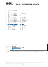
Used for SDI-12 communications, see below. For generic information on SDI-12 see:
SDI-12_SDI-12
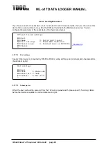
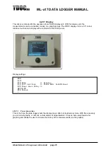
SDI12 sensor
[0]
Exit
[1] Name >> SDI12
[2] Port settings >> SDI12; 1200 Baud; Address 0
[3] Sensor power switch >> Enabled; Warm up
00:00:01
[4] Sample interval >> Data log interval
[5] Measurement command >> 0C!
[6] Parameter 1 >> Par1
[7] Parameter 2 >> Not used
[8] Parameter 3 >> Not
used
[9] Parameter 4 >> Not used
[A] Parameter 5 >> Not used
[B] Parameter 6 >> Not
used
[C] Parameter 7 >> Not used
[D] Parameter 8 >> Not used
[E] Parameter 9 >> Not used
[M] More parameters >> Not used
[R] Remove
[T] Test measurement
>

